The Plotlands was a community of people who resided in Laindon between 1900s and 1980s, located predominantly in the South West of Laindon. The Plotland properties were built by families (mainly from London’s East End) who bought individual plots as freeholdings. Although originally intended as holiday homes, the Second World War meant that many families came to live in their Plotland homes permanently. The huts and houses were made from various salvaged materials and structures: army huts, old railway coaches, sheds, shanties and chalets, which evolved over time. This area in Victoria Park was sold as plots in 1904 by land agent,
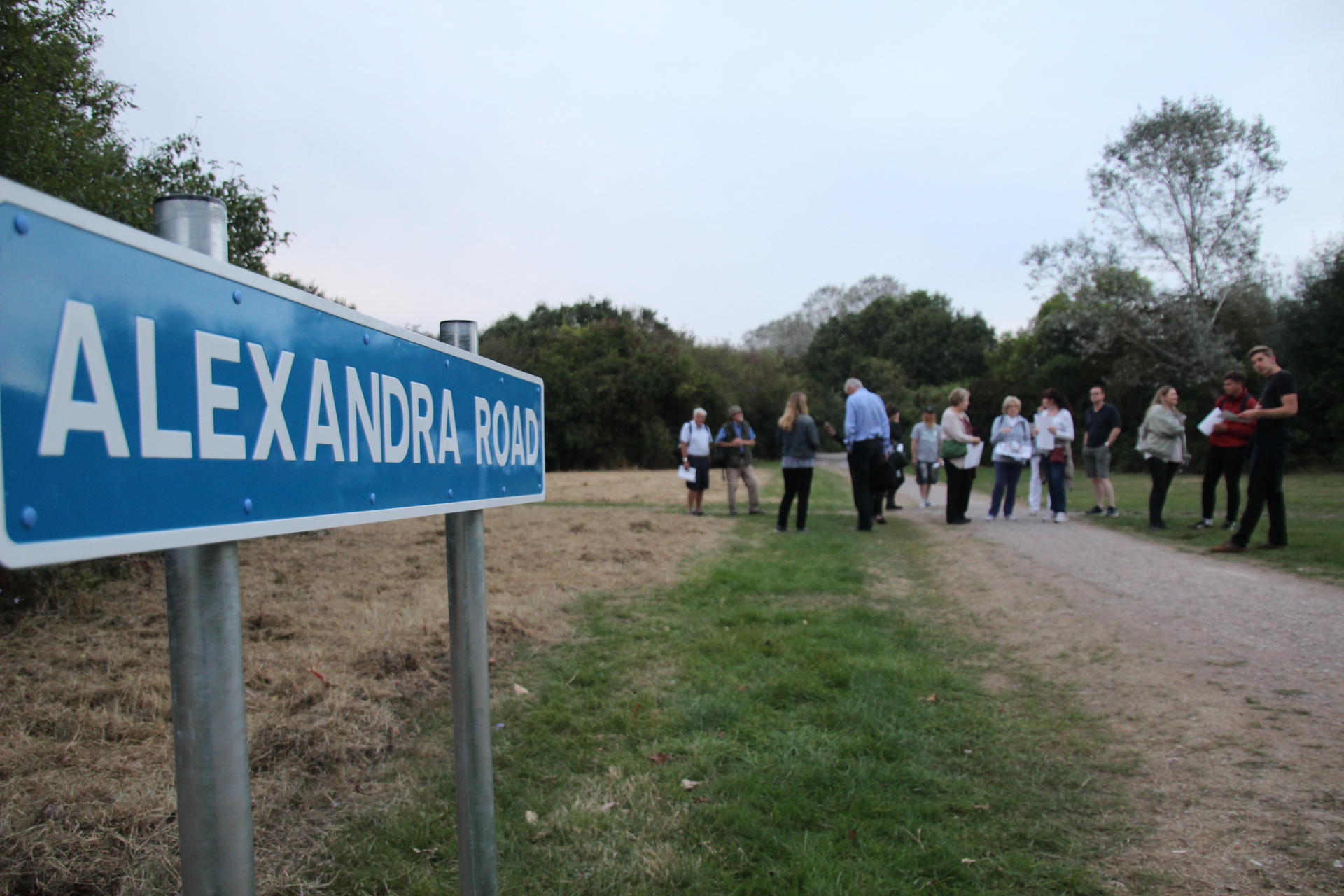
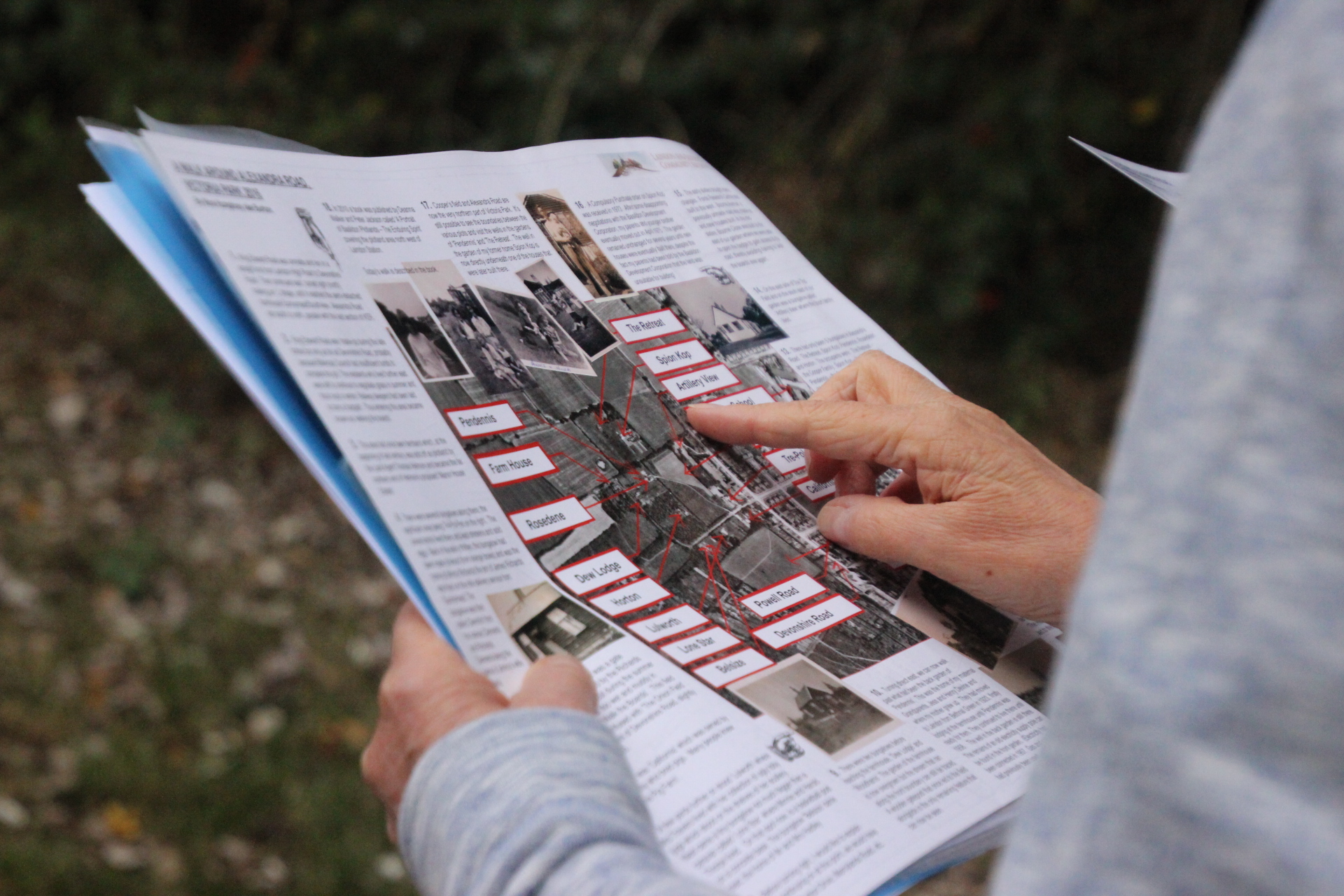
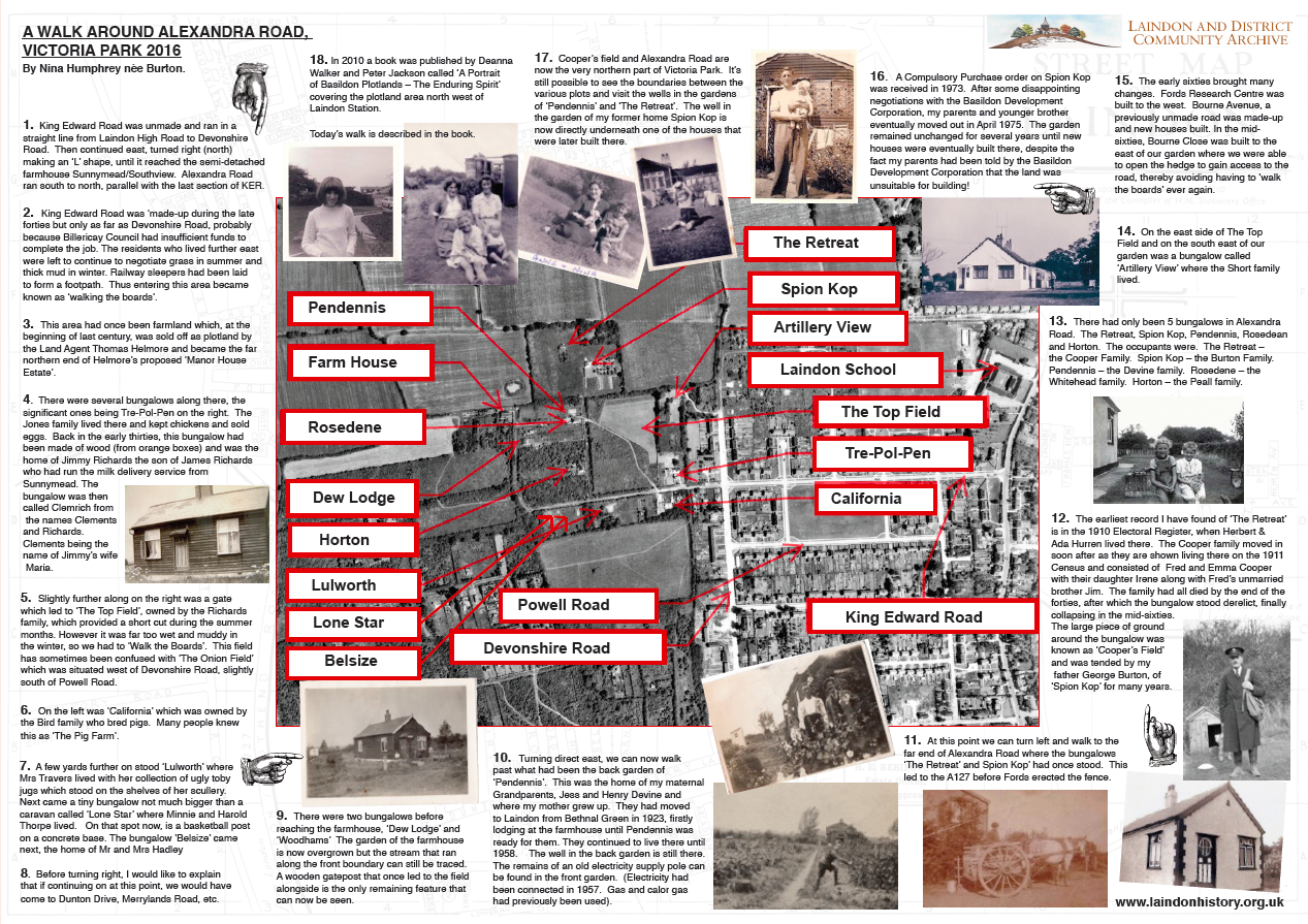
Thomas Helmore and became part of his ‘Manor House Estate’. Alexandra Road never had a road sign but there were five bungalows along its length; The Retreat, Spion Kop, Pendennis, Rosedean and Horton. The road was used as a short cut from Buckenham’s Farm as it led further into Laindon. Alexandra Road was surrounded by open fields and farmland.
Most residents grew their own vegetables, kept chickens, ducks, goats and even a pig. There were no amenities until the early 1930s. Gas was installed as far as Pendennis but it didn’t extend up to Spion Kop, where Calor Gas cylinders were used. There were never any main drains for sewage, refuse collections, running water (wells were used) or street lights. Electricity was connected in 1957 and telephones a little later.
In Victoria Park today you can still find remnants from the Plotland period. There are two wells now located in shrubbery, one was initially outside the kitchen of ‘The Retreat’ and the other was in the back garden of Pendennis. In the north west part of the park, as you head to Ford Dunton Technical Centre, you can find an old post which dates back to 1920. This post was part of the Farm House gate that was the entrance to the Richards Family dairy farm that was operational between 1919 to 1940s.
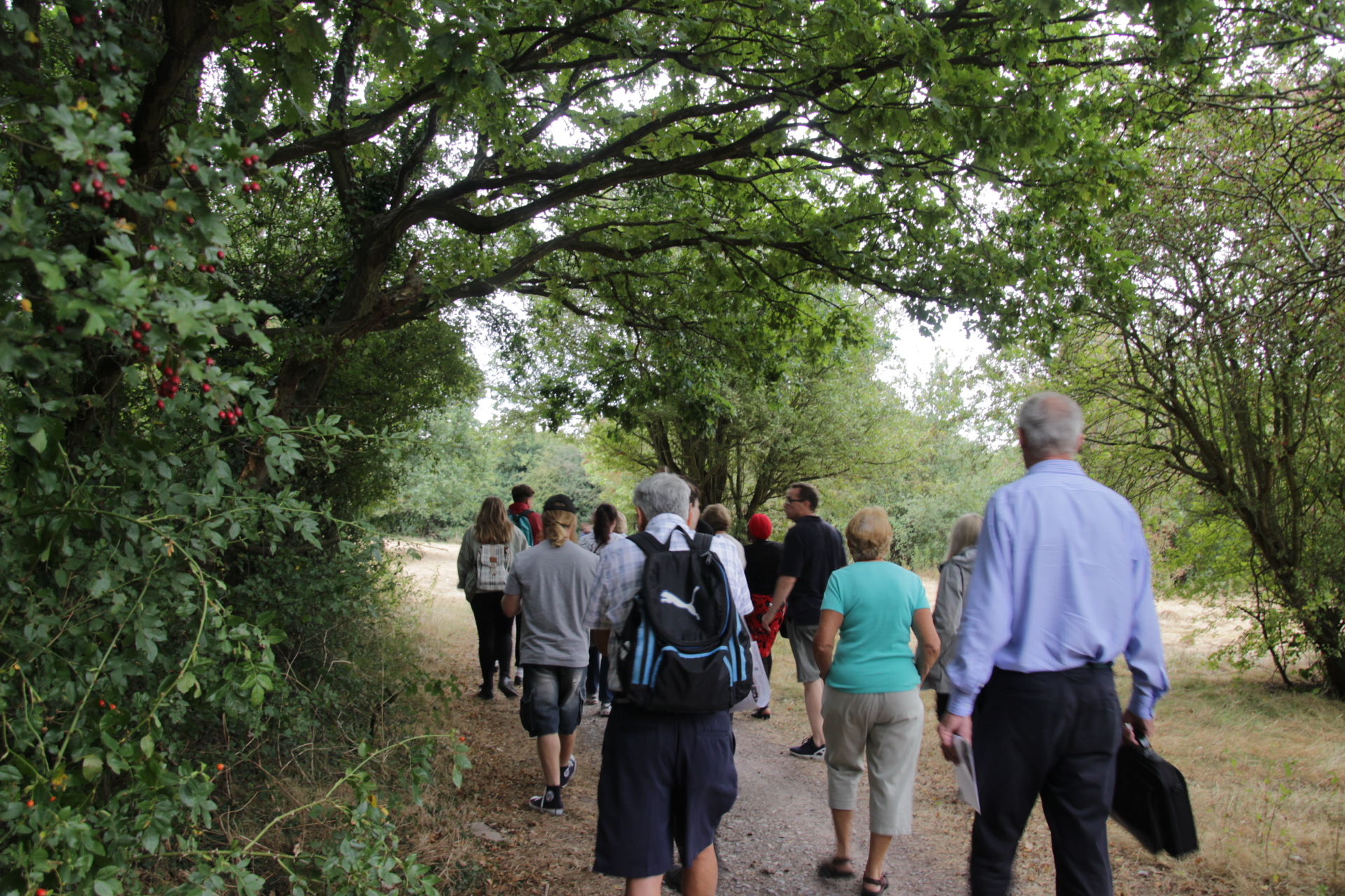
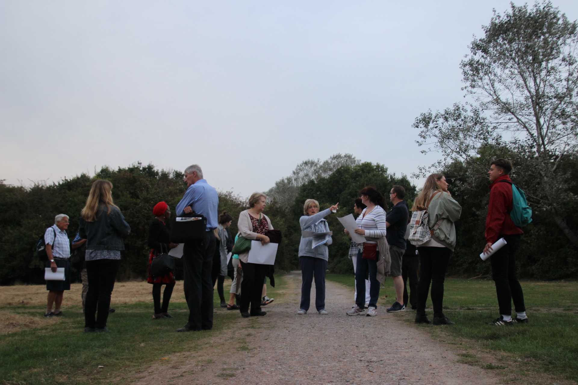
In September 2016 a memory walk with Nina Humphrey was co-ordinated round the previous plotland area in the North part of the park. A temporary road sign was installed titled Alexandra Road, where the road sign would have sat and a custom map was made for participants to view while walking with Nina. Funding is being sourced to permenantly install the Alexandra Road sign in Victoria Park alongside a lectern that outlines the local Plotland history in the town and the park.